
01
Those who organise
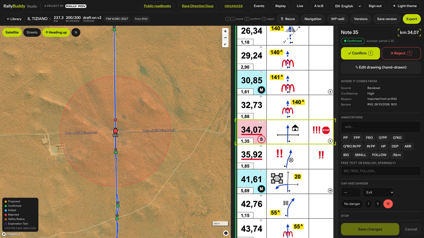
Automatic RoadBook generation, reviews, reconnaissance and complete event management, from entries to the standings.
Rally Buddy
Artificial intelligence comes to the RoadBook: everything organisers, riders and enthusiasts have always dreamed of, in a single ecosystem. The online Studio for those who organise and coach, the free app for those who race.
From this experience in the field
Paris Nordkapp is a journey from Paris to the North Cape entirely on RoadBook or GPX: for the Rally classes it is around 6,000 km across seven countries, with a very high share of off-road every day. Plotting over 6,000 km of RoadBook is an enormous challenge.
From this experience in the field, together with Manuel Podetti, partner and co-founder of Paris Nordkapp, Rally Buddy was born: a single ecosystem for those who organise, those who coach and those who race, from the first draft of the RoadBook to the standings, through reconnaissance, training and the race.
A single ecosystem
The online Studio is for those who organise and coach, the app for those who ride: for riders it is always free.
01
Automatic RoadBook generation, reviews, reconnaissance and complete event management, from entries to the standings.
02
Training sessions with tailored rules, errors flagged to the rider while riding and replays to comment on note by note.
03
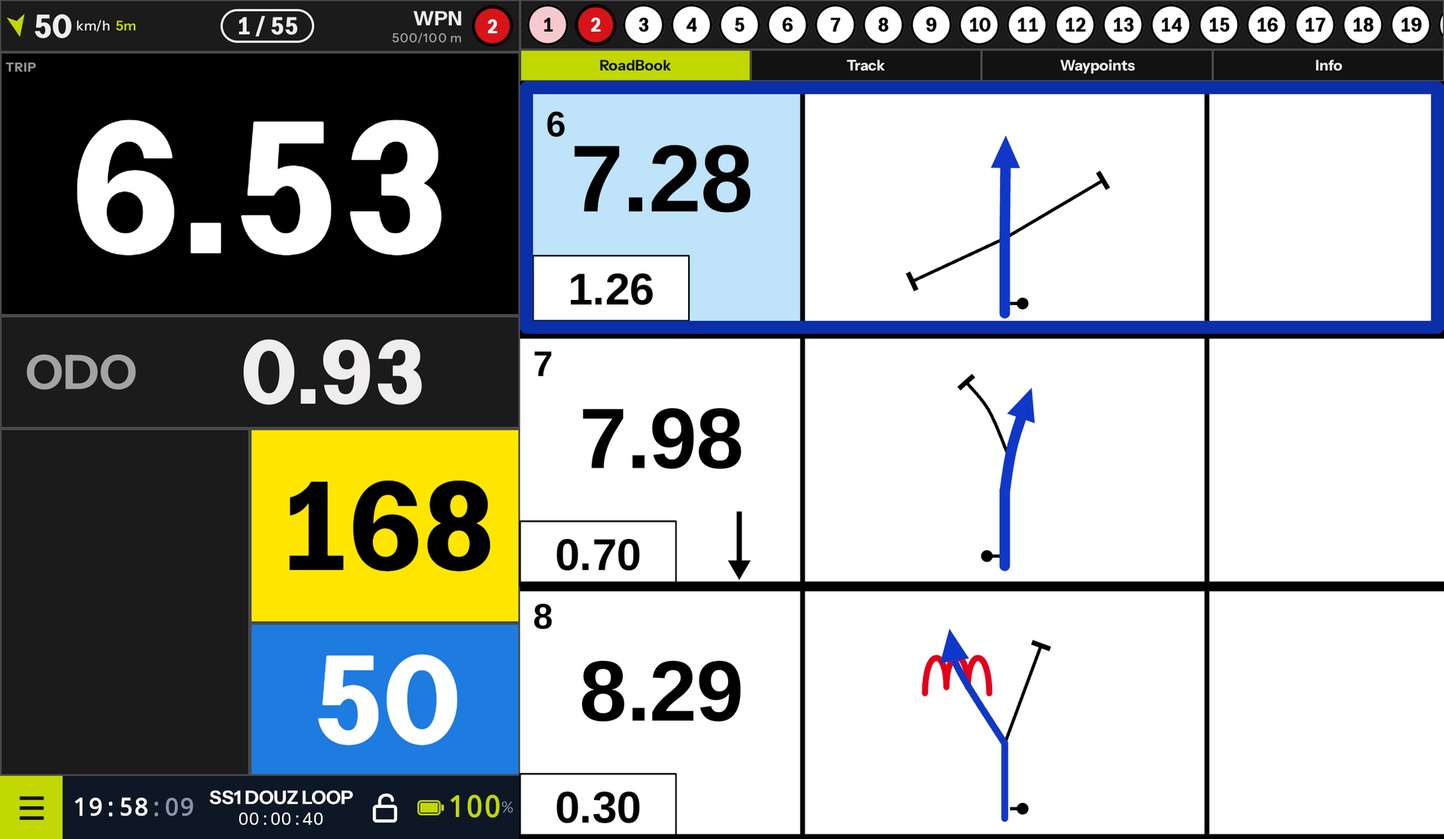
A free app with RoadBook and GPX, dangers, speed zones and features designed for safety in the saddle.
The Studio is online at rallybuddy.it. The app for riders is free, on Google Play; on the App Store for iPhone and iPad in a few days.
Six steps, from the track to the standings.
Upload a track or draw a route from A to B.
Every note comes with drawing, CAP, dangers and surface.
In the Studio you validate, correct and redraw every note.
RN2, Dakar PDF, OpenRally GPX or direct send to the app.
Entrants, timings and rules, with encrypted stages for every rider.
App in the saddle, live feed for race control, standings and replays.
Automatic creation
Rally Buddy reads the track and the cartography of the area, then proposes every note with a realistic drawing, CAP, dangers, surface and landmarks. A 104 km stage is processed in about one second.
Note density and regulation profile are chosen before generation, and every parameter remains editable. The track is sacred: the GPX stays identical point by point.
≈ 1 s
for a 104 km stage
from the GPX track to the RoadBook
16
waypoint types
FIM W2RC 2027 regulations
135
icons
inspired by the FIA lexicon
6,000 km
of RoadBook
the Paris Nordkapp experience
The app for riders
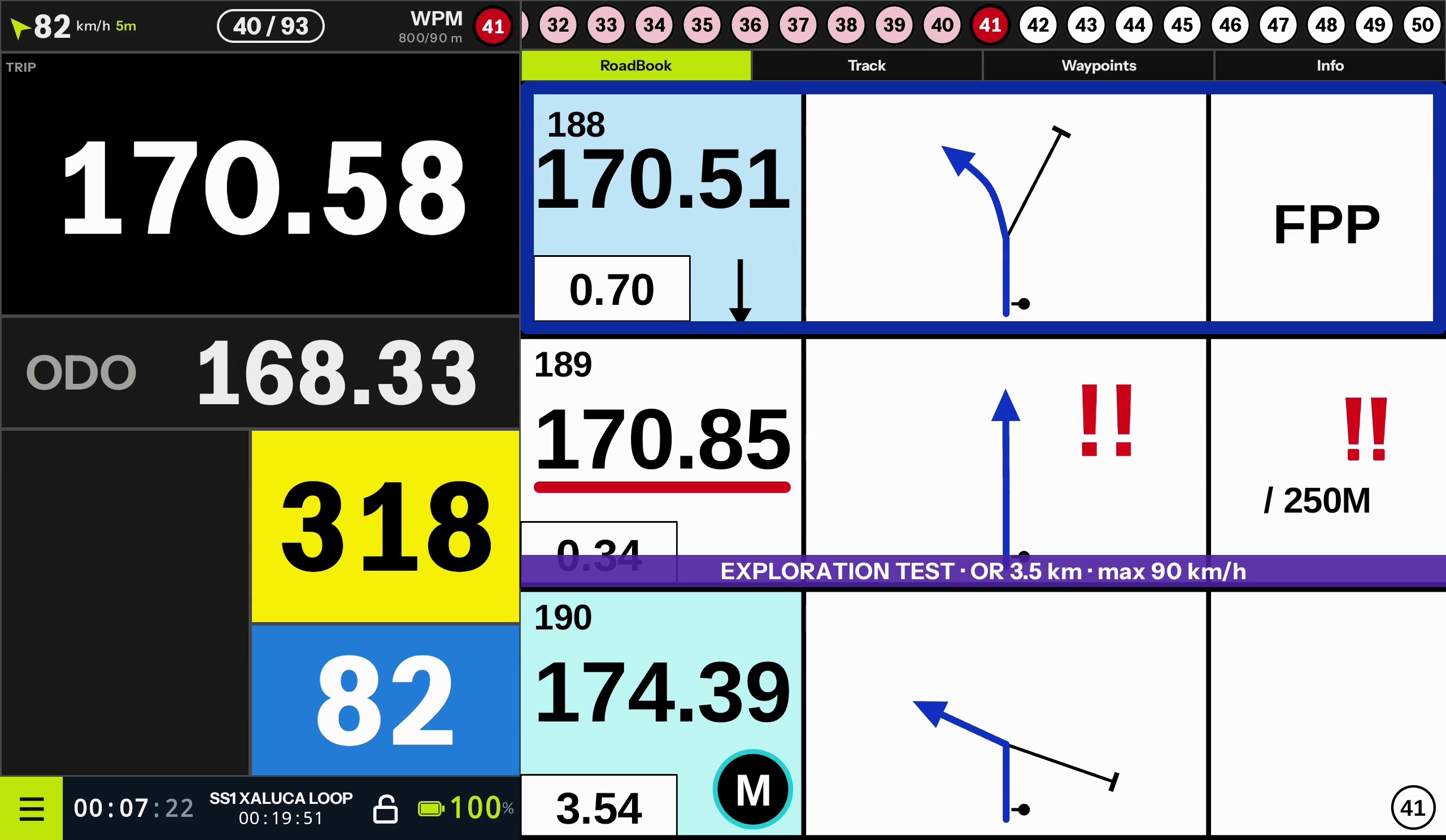
TRIP and ODO, CAP, remote control, waypoints, speed zones, neutralisations and STOP. It works offline: RoadBook, tracks and maps are downloaded to the device in advance.
Free for riders, on Google Play for Android and in a few days also on the App Store for iPhone and iPad.
GPX navigation
On the GPX track the app announces dangers, speed zones and critical points in advance, with the distance remaining. The rider no longer has to interpret a line on the map: they receive the information they need to navigate safely.
Truly safe navigation, even for those who have never used a RoadBook.
Safety and fun
Tools that make navigation safer, fairer and more fun, in training and in the race.
01
In training, if you leave the radius set by the tutor, the app warns you and takes you back to the last validated waypoint with a back-track arrow. With GPXAssist a picture-in-picture map over the RoadBook helps you find your way again; the organiser decides whether and how much to penalise the help.
02
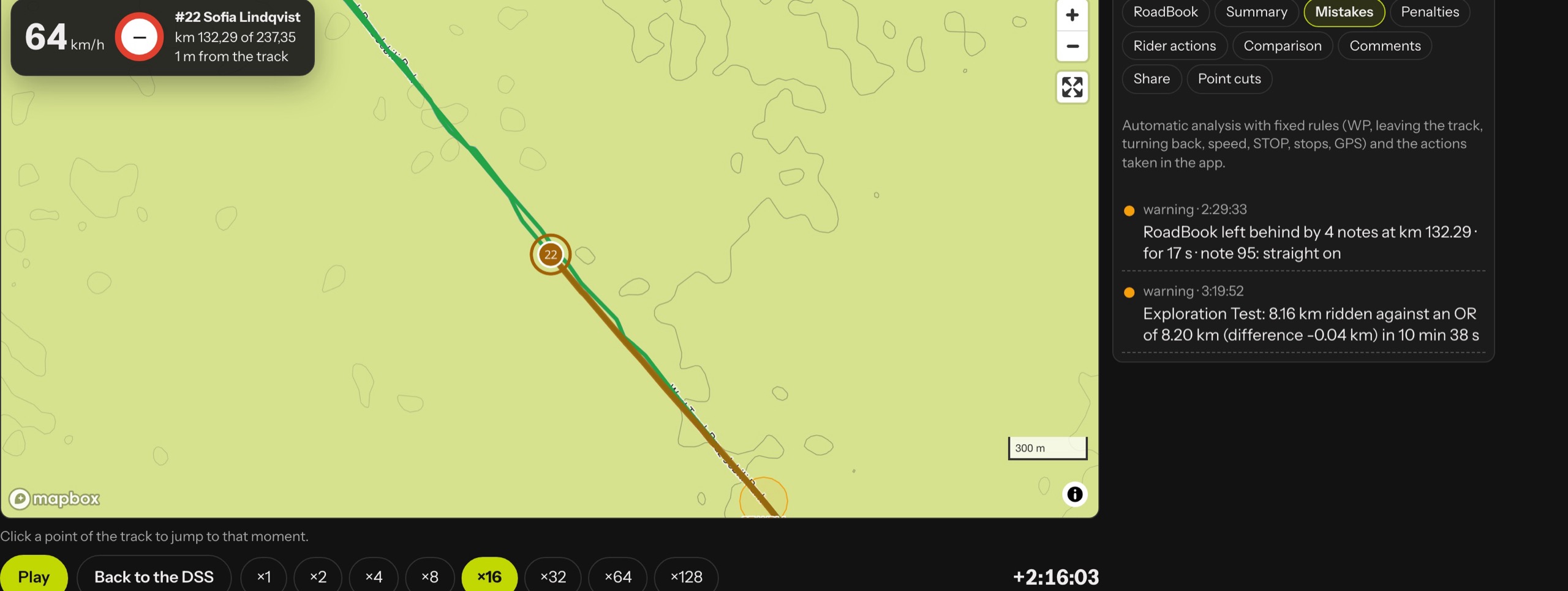
The most dangerous mistake is not getting lost, but being almost on the right road. A corridor drawn by the organiser only where leaving it is dangerous: silent inside, a discreet warning outside. Race control knows who has left the corridor, where and for how long.
03
When the RoadBook falls behind, the rider stops navigating and starts following the tracks or the rider ahead. LateNote measures it: recorded in the race, shown on screen if the organiser chooses, explained in the replay.
04
Between two notes, the RoadBook switches off. The rider has only the map, the arrival waypoint and the Optimal Route in kilometres: no track to follow, they read the terrain and choose their own line. Safe, because the speed limit and the arrival radius remain.
05
After the stage every rider reviews their own replay alongside the RoadBook, with the errors and the time lost note by note. The tutor comments on every note and every error; once the stage is closed the Studio generates a PDF report for every rider.
Exploration Test
At the start note the RoadBook switches off and a map appears in its place, with the arrival waypoint and the Optimal Route in kilometres; from there on, the line between the two notes is the rider's choice. Those who cut straight towards the waypoint and those who follow the trail end up on the same map, even live: it is the clock that says who chose best, and the shortest line is not always the fastest.
Pure navigation, measured in kilometres and seconds. Easy to tell: on television, on social media, at the bivouac.
The future
rallybuddy.it
Create your first RoadBook in the Studio, or download the app and try RoadBook and GPX navigation on your next training ride.


Ti portiamo all'iscrizione
Iscrizione e pagamento avvengono su Roadbooking, la piattaforma ufficiale delle iscrizioni HAT.